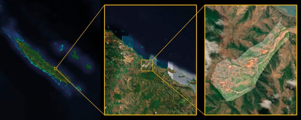
Drones Pacifique Services mapped a 320 ha / 790 ac former open-pit mine in New Caledonia for soil restoration. The main challenges were maintaining a homogeneous GSD with different bench heights and site inaccessibility. The eBee X drone, S.O.D.A. 3D camera and eMotion flight planning software allowed the team to efficiently generate a high-resolution 3D model.
Project Details
| Type of mission – Environmental monitoring | Outputs – Orthomosaic, Point Cloud, DSM |
| Area – 3,2 km 2 / 320 ha / 790 ac | Total images – 1531 |
| Drone – eBee X with S.O.D.A. 3D | Processing time – 8h |
| GSD – 5.75 cm / 2.26 in | Processing software – PIX4Dmapper |
| RTK/PPK – PPK | Location – New Caledonia |
| Flights needed – 3 | Data provided by – Frédéric Valade, Drones Pacifique Services |
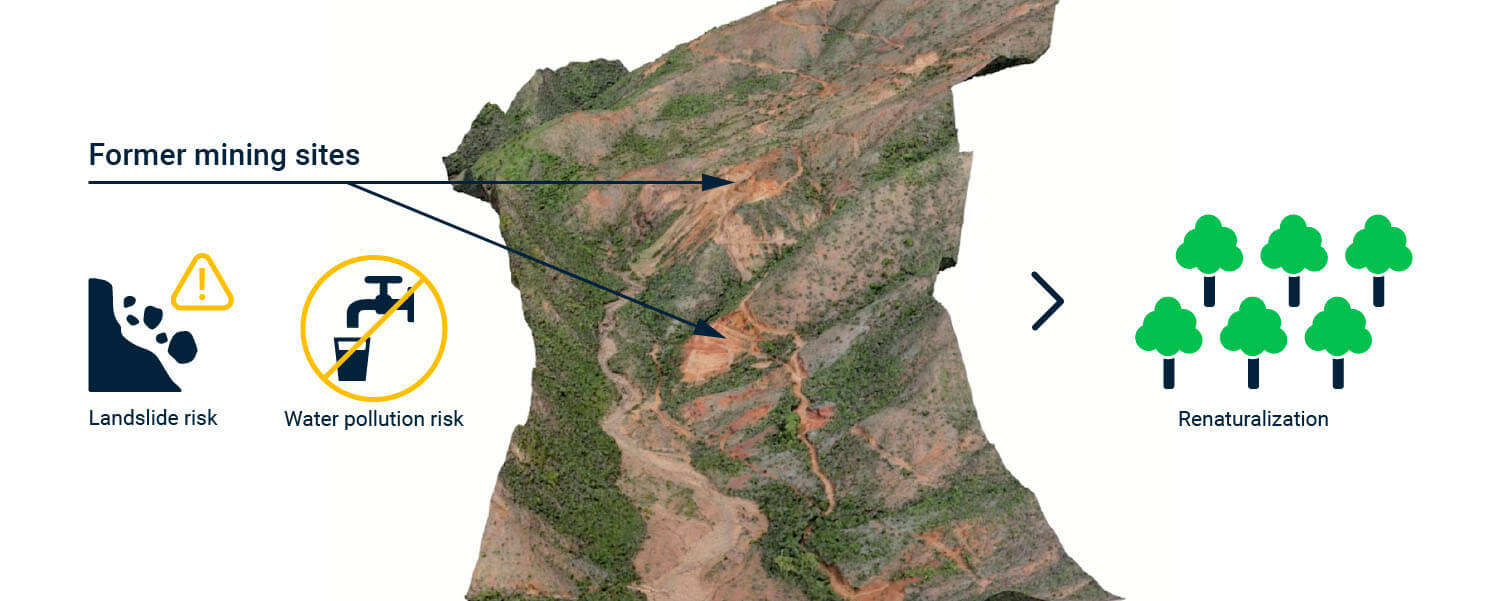
One of Fonds Nickel’s goals is revitalizing areas degraded by former mining activity to prevent them from causing major environmental damage, such as water pollution or landslides.
The public administrative establishment of this French territory located in Oceania commissioned Drones Pacifique Services to perform several topographic surveys in mines around the country – a total of 1,878 ha – before proceeding with a vegetation plan.

Challenges of Mapping a Mining Site
As with every large and degraded site, this mission in the Thio mining center encountered a few challenges.
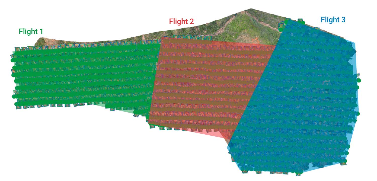
The first was the pit’s different bench heights, which demanded flight planning software and a drone that could map accordingly. The Drones Pacifique Services team flew the eBee X three times and used both eMotion’s elevation data option, which automatically adjusts the flight plan altitude to precisely track terrain with large elevation changes, and optimized flight lines orientation to maintain a homogeneous GSD in all the mapped areas – in this case of 5.75 cm / 2.26 in. This allowed the team to get sharper and more accurate results.


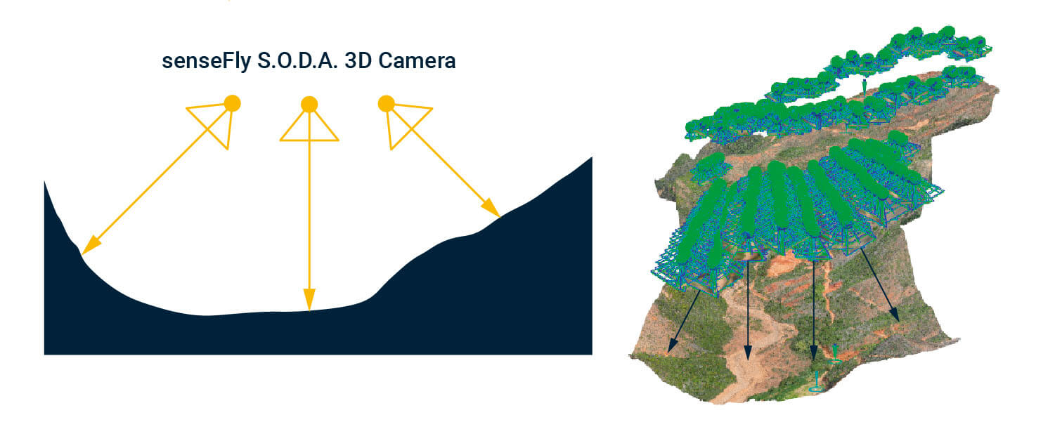
The senseFly S.O.D.A. 3D drone camera, which changes orientation during flight to capture two oblique images and one nadir, was selected for this mission.
“The S.O.D.A. 3D provides better coverage and reconstruction of the bench height and lateral facades. It allowed us to obtain a very high-density point cloud”, states Frédéric Valade, director of Drones Pacifique Services.

The next issue was site security. As M. Valade recalls, “the access on the sites in fallow for several years is not obvious. Having agreements with the civil aviation in New Caledonia, we could intervene at around 2 km / 1.2 mi from the area mapped. This is thanks to the reliability of the senseFly drones”.
In short, environmental monitoring with a drone helped improve job site safety. M. Valade underlines that “it requires good preparation of the flights and good organization on the ground. A spotter in the field maintains visual contact with the drone to ensure that everything goes as planned and checks for the presence of birds”.

The third concern was the large surface of the open-mining site (3,2 km2 / 320 ha). They needed a UAS that could efficiently cover the maximum distance in just one flight. “The choice was made to use a fixed-wing because of the advantages of this type of equipment,” says M. Valade. The maximum flight time of the eBee X, for example, is 90 minutes with an endurance battery.
Improving Mining Rehabilitation Forecasting
During the four flights, a total of 1,531 georeferenced images were collected. The team placed five ground control points and opted for PPK. M. Valade adds that this technology is used in all missions “in case of loss of radio link between the base and the drone”.
In particular, the outputs generated and processed with PIX4Dmapper allowed Fond Nickel to:
- Identify the degradation of the slopes due to runoff.
- Carry out in-depth technical studies with good financial forecasts.
- Identify existing vegetation and plan for better revegetation of the sites.
- Monitor the progress of the work during the implementation phase.
- Perpetuate the choices made.

This story was sourced from an entry in the 2021 senseFly & Pix4D Photogrammetry Awards, in the Environmental Monitoring category.


