Due to its increased threat to the sustainability of forest ecosystems in recent years, foresters are turning to modern and efficient tools that can help manage and control an infestation.
In Poland, the Jelna Forest District, located in the Podkarpackie Province, about two hours east of Krakow, is starting to use drone technology to map the health of a coniferous forest and monitor the spread of the bark beetle.
The technology
Satellites have long been used for forestry work, and advances in satellite technology mean there is more frequent data capture, at a higher resolution than in the past. However, satellites still have their limitations with spatial resolution and weather conditions, not being able to capture on cloudy days. UAVs provide an excellent complement to satellites for these reasons. There is an advantage with drones to be able to respond quickly and capture time-sensitive data, at the high resolution required to thoroughly analyze areas of interest.
The project
Jelna’s forestry district contracted NaviGate, Arnold’s partner and exclusive reseller in Poland, to map divisions 93 and 94 of the Le?ajsk forest – Approximately 14 ha of common pine (90%), pedunculate oak undergrowth (8%), hornbeam (1.5%), and single beech trees (0.5%); with a known infestation of bark beetle.
The mission was carried out using the MicaSense series Altum sensor for high-resolution multispectral data. The objective was to assess the tree crown damage done by bark beetle and to quantify the resulting deadwood. The mission was flown on a DJI Matrice 210 at a flight altitude of 110m AGL.
Data processing
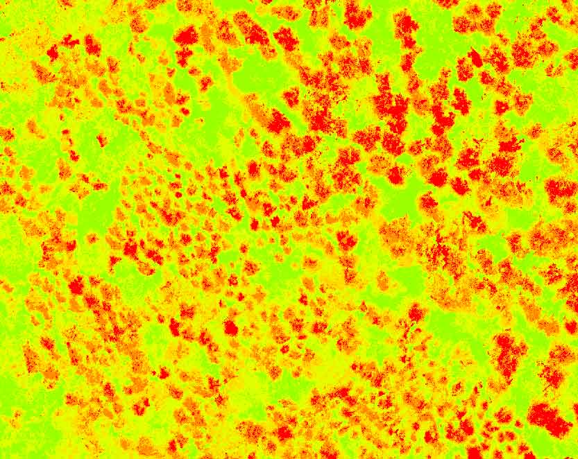
After processing the Altum data in Agisoft Metashape, NaviGate generated an NDVI map and a CIR composite map. Further data manipulation was carried out in QGIS, to identify tree crowns showing signs of defoliation and stress.

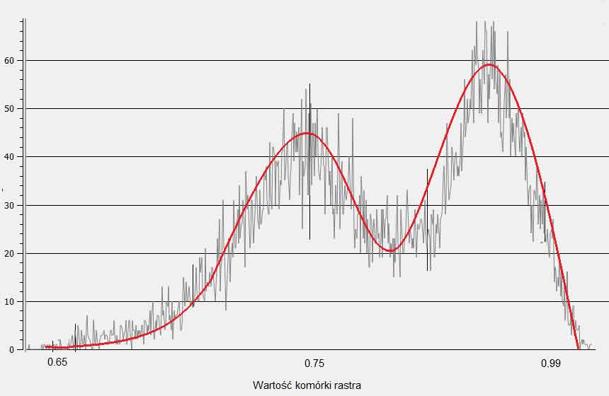
The average NDVI value in the area occupied by pine was 0.74 (± 0.05), and 0.95 (± 0.4) in areas with deciduous species. These differences can be clearly visible on the histogram with a typical bimodal distribution in such cases.

In the last stage of the imagery analysis, a supervised classification was made to determine tree health. Seven classifications were generated, based on species division (i.e., coniferous) and tree health stages. The results showed that over 10% of the trees in the area were dry, deadwood, or had secretive active dry matter. The remaining 23% were weakened trees with a progressing defoliation process, which should be marked for removal in subsequent years. The ratio of healthy to weak trees was very high at 2.2 to 1.
After analyzing the data collected, NaviGate was able to deliver this information to the forestry district for their use in further diagnosis, support, and monitoring.


Conclusion
The DJI Matrice 210, the Altum camera, Agisoft processing software, and QGIS, proved to be an effective toolkit to support diagnostics and monitoring of forests in the initial period of their growth. This technology reduces the time required to obtain data which results in significant savings compared to other methods.
For more information on the work that NaviGate provides for forestry groups, click here.
For the original, full article click here.


