We sat down with the Hydro Visio team to discuss how fixed-wing drones have helped them in hydropower plant planning and creation — increasing efficiency and accuracy from their previous methods.
Hi there, Hydro Visio team! Can you please provide an overview of your business?
Hydro Visio consists of two consultants who came together to create a small hydropower plant business. Rémi Raimbault is a cartographer and geometer. He worked for engineering companies that specialized in green energy before becoming a drone pilot in the video entertainment industry for mountain sports. Then there’s Patrick Alléoud, an engineer who specializes in the construction of small hydropower plants.
 Mapping mission of an old chapel on a ridge.
The company originated in 2013 when Patrick needed a topographic survey of a large area for a project. He spoke with his friend Remi, and the opportunity to have a career using drones came to life. That’s how Hydro Visio was born.
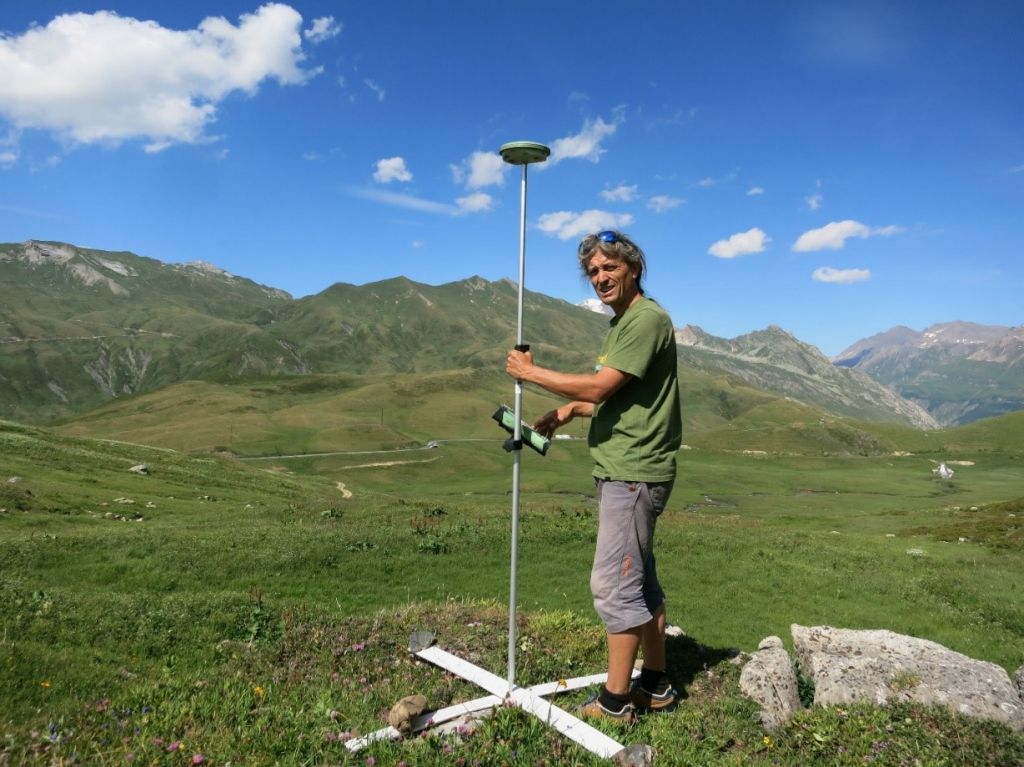
 Obtaining the coordinates of the GCP with a high precision GNSS.
How did you accomplish your work prior to using drones?
Before using drones, we used satellite maps, which had a lot of mistakes and weren’t very precise. We also made topographic surveys through GPS and theodolites, but the density points were weak, and the areas were always small. For example, if we decided to change the track of a penstock, we had to create a new topographic survey. The cost of those surveys was the deciding factor.
What challenges did you face that caused you to consider drone technology?
During a small hydroelectric plant project in the Alps, we realized the lack of good topographic surveys had created more earthwork for us. We didn’t consider that we’d have so much excess without a place to store it. That’s the moment we knew a drone could help us solve this problem.
Which drone models did you originally assess and what made you decide to go with eBee?
We originally used a multirotor F450 and a fixed-wing LA 300 from Lehmann Aviation. However, we knew that the eBee was the best drone to do what we needed. We just didn’t have the funds available in the beginning.
Which eBee model(s) do you fly?
We currently fly the eBee X.
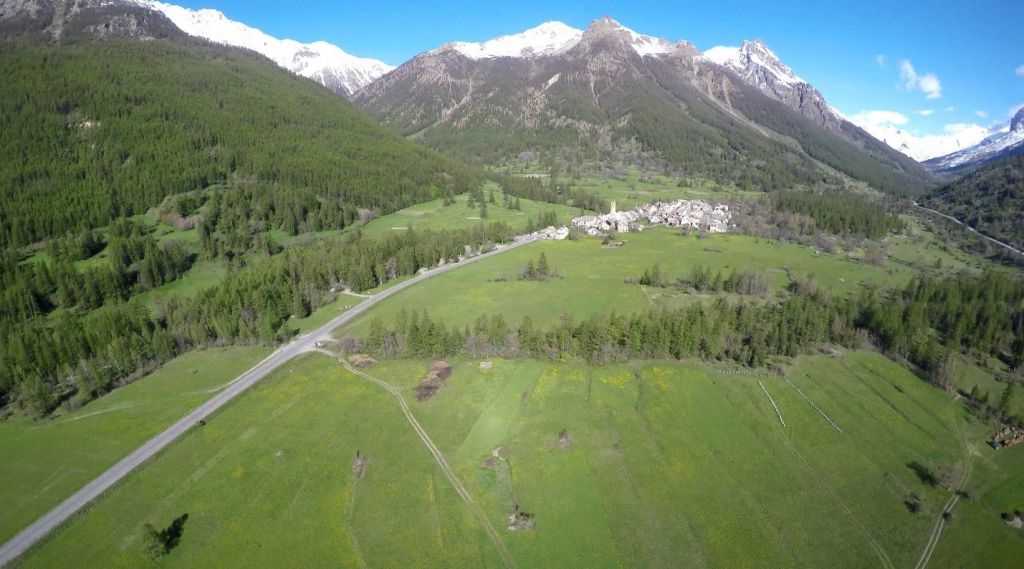
 eBee X coming back to home base after a large area mapped in the French Alps.
What does a typical workflow/project involving your eBee X look like?
During feasibility studies, we use the eBee X to make a large topographic survey of the valley where the power plant is projected to be. The area must be large enough to enclose the water intake, penstock and power plant in addition to earth roads and temporary construction zones.
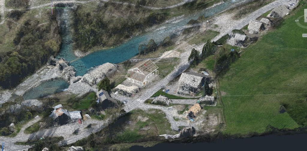
 Drawing of the future hydropower plant in the point cloud.
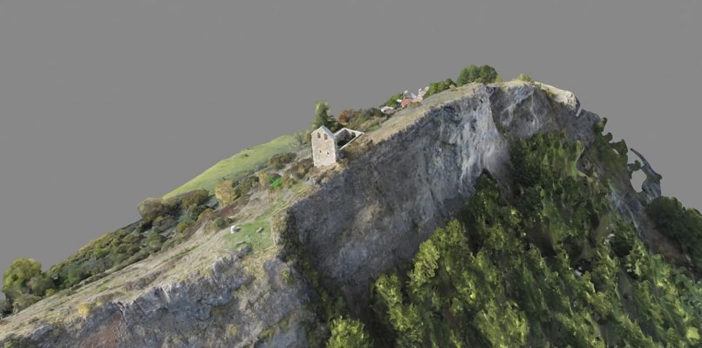
 3D mesh of an old chapel on the ridge.
During construction, we use the eBee X to make topographic surveys of the penstock, construction buildings and follow/control the project’s completion status.
What benefits are you getting from using drones?
There are quite a few benefits. Drones are simply more efficient, quicker and more profitable than traditional topographic surveys. Drones also provide more information, such as orthomosaics or orthophotos.
 The Hydro Visio team loves getting to fly the eBee X in beautiful regions.
How accurate was your data collection before using drones?
Before using the eBee X, our data collection was approximately one meter off. With the eBee X, our data collection accuracy has increased tremendously, as it is now approximately less than five centimeters, on average.
Has using drones positively impacted your business?
Since using the eBee X, our studies are more precise. We have progressed in BIM and can create real 3D models of all our projects – from water intake to power plants. These models make it easier to assess the amount of concrete, earthwork, etc., needed to complete a project. We still create topographic surveys for companies but use our drone to do so. Drones have also allowed us to grow our business and expand into other industries.
What are some challenges you face when using drones?
We’ve had some difficulty flying in mountainous areas and weak GPS signals. In foreign countries, we’ve had an issue with GCPs because of the GPS, as well. However, we’re able to use the eBee Geobase to fix this problem and work in local coordinates.
What’s next!? Are you working on any interesting projects?
As a matter of fact, we are. We will use the eBee X to follow some construction of another hydropower plant in the Alps. We’re also going to make several topographic surveys in Africa later this year.


