SOFTWARE

Measure Ground Control

Complete software platform for drones.

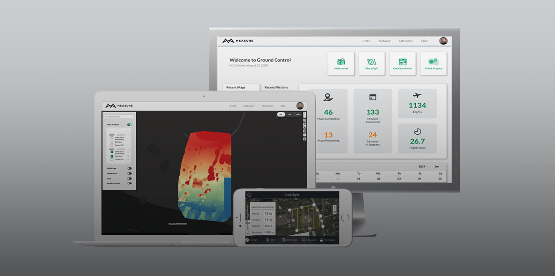
Everything you need to automate your UAS operations, manage equipment and teams, fly safely, and analyze your data on our cloud-based platform and mobile app. Mapping powered by PIX4Dengine.

Log in to Measure Ground Control

Video

Automate your drone operations

Features

Actionable aerial intelligence, right at your fingertips

Feature 1 - Autonomous flight control and data collection

Autonomous flight control and data collection

  • Plan and manage flight operations from our cloud-based web platform.
  • Fly with GPS-aided manual control or automated grid and waypoint patterns.
  • Automatically sync web-created flight plans to our mobile flight app.
  • Automatically upload flight logs, images, and data. 
  • Block DJI data-sharing; request and apply DJI GEO Unlock.
  • Check airspace and weather conditions.

Feature 2 - Program Management & Compliance

Program management & compliance

  • Plan missions, track program activity, and manage operations on our cloud-based platform.
  • Create a grid or waypoint flight plan by uploading a KML file.
  • Access detailed flight log information like screenshots, flight playback, and flagged incidents.
  • Employ equipment management with automatic usage tracking.
  • Program activity reporting.
  • User management with permission-based access control.

Feature 3 - Data Process and Analysis

Data processing and analysis

  • Process imagery into high-quality data products powered by the industry leader in photogrammetry, Pix4D.
  • Increase image processing accuracy with RTK drone data. Upload ground control points (GCPs) with your maps for increased accuracy.
  • Create orthomosaics, digital surface models, contour and multispectral maps. 
  • View, export and share your 2D and 3D data files on an interactive, account-wide map.
  • Measure linear distance and area.
  • Benefit from multispectral data processing and analysis.
  • Sort data according to your needs with inspection annotation, such as classifying defects or adding comments.
  • Turn on layers like flight plans and paths or import your own layer.
  • Export and share maps and program activity reporting.

Feature 4 - Integrations with existing customer systems

Integrations with existing customer systems

  • Custom reporting across all data types to accommodate enterprise-specific needs.
  • Intelligent inspection modes to collect data on specific asset types. 
  • Inspection data analysis tool for energy infrastructure.
  • User access to multiple company resources with one login (SSO).
  • Sync asset management system data like SAP and Cheqroom.
  • Custom setup and onboarding process.

Why Measure Ground Control

Why 1 - User friendly

User friendly

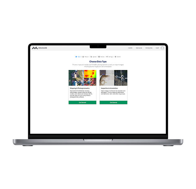
Complete your entire workflow without switching between software applications.

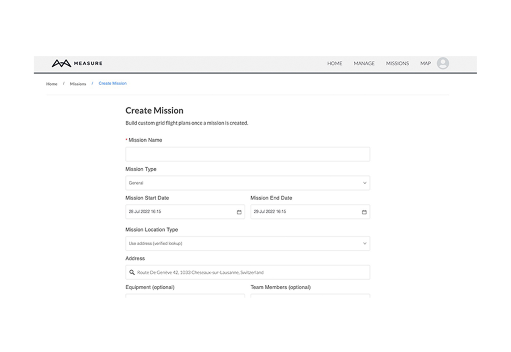
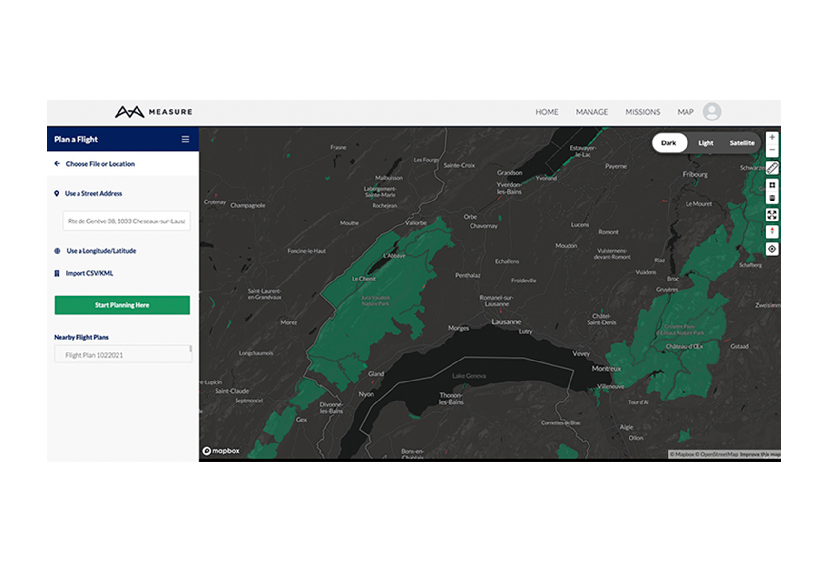
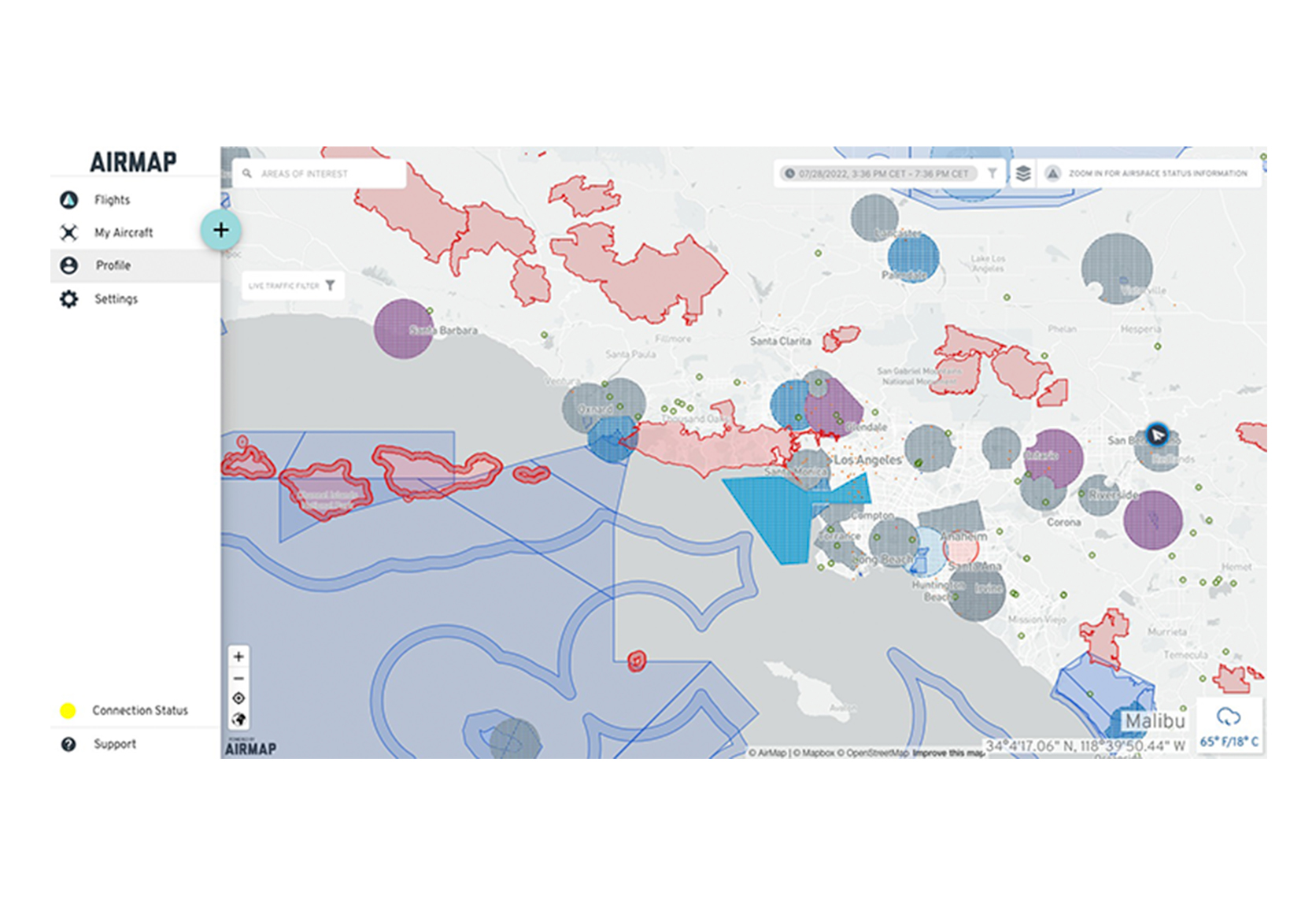
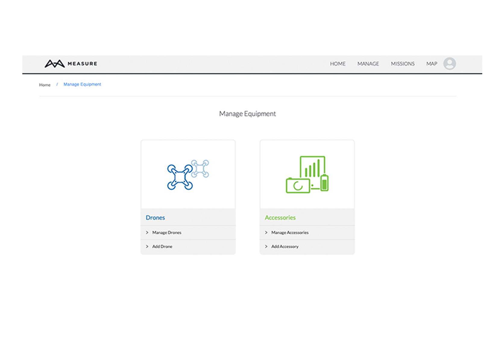
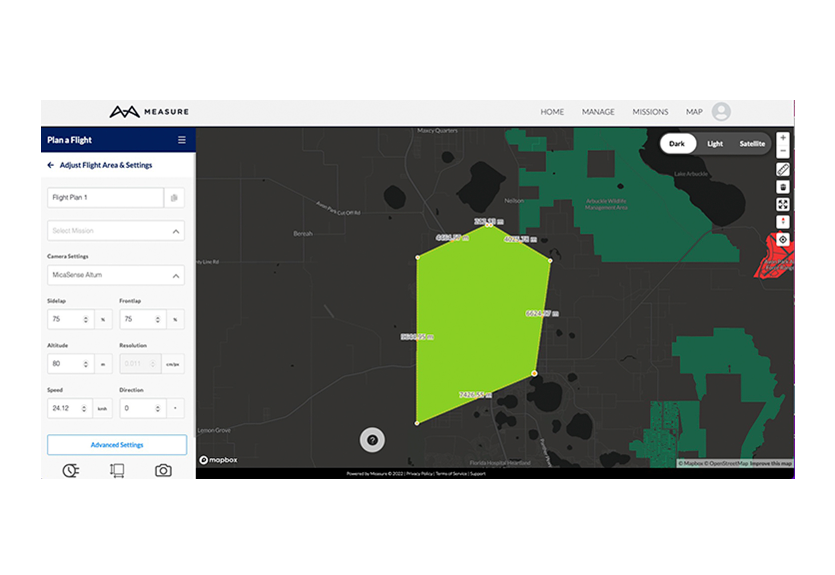
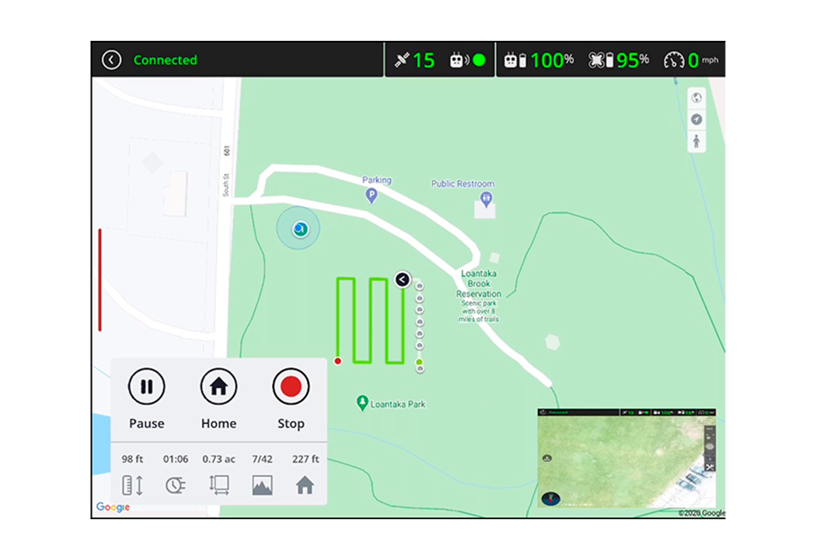
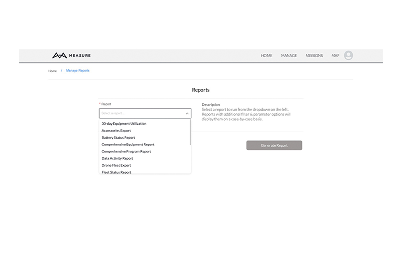
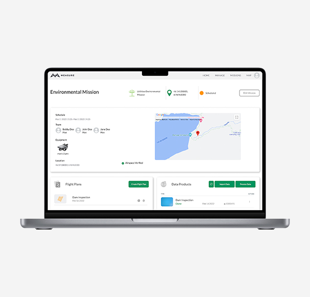
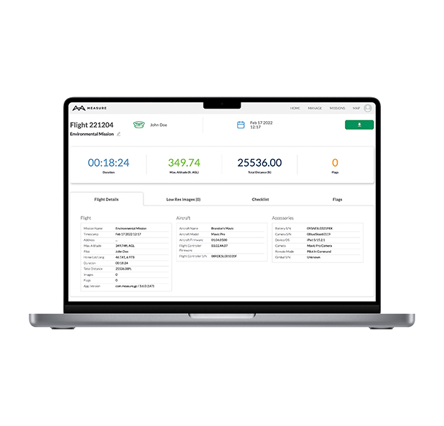
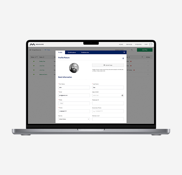
Easily schedule missions, manage resources and operations, track program activity, upload and playback flight logs, flag incidients, and access detailed information in real-time.

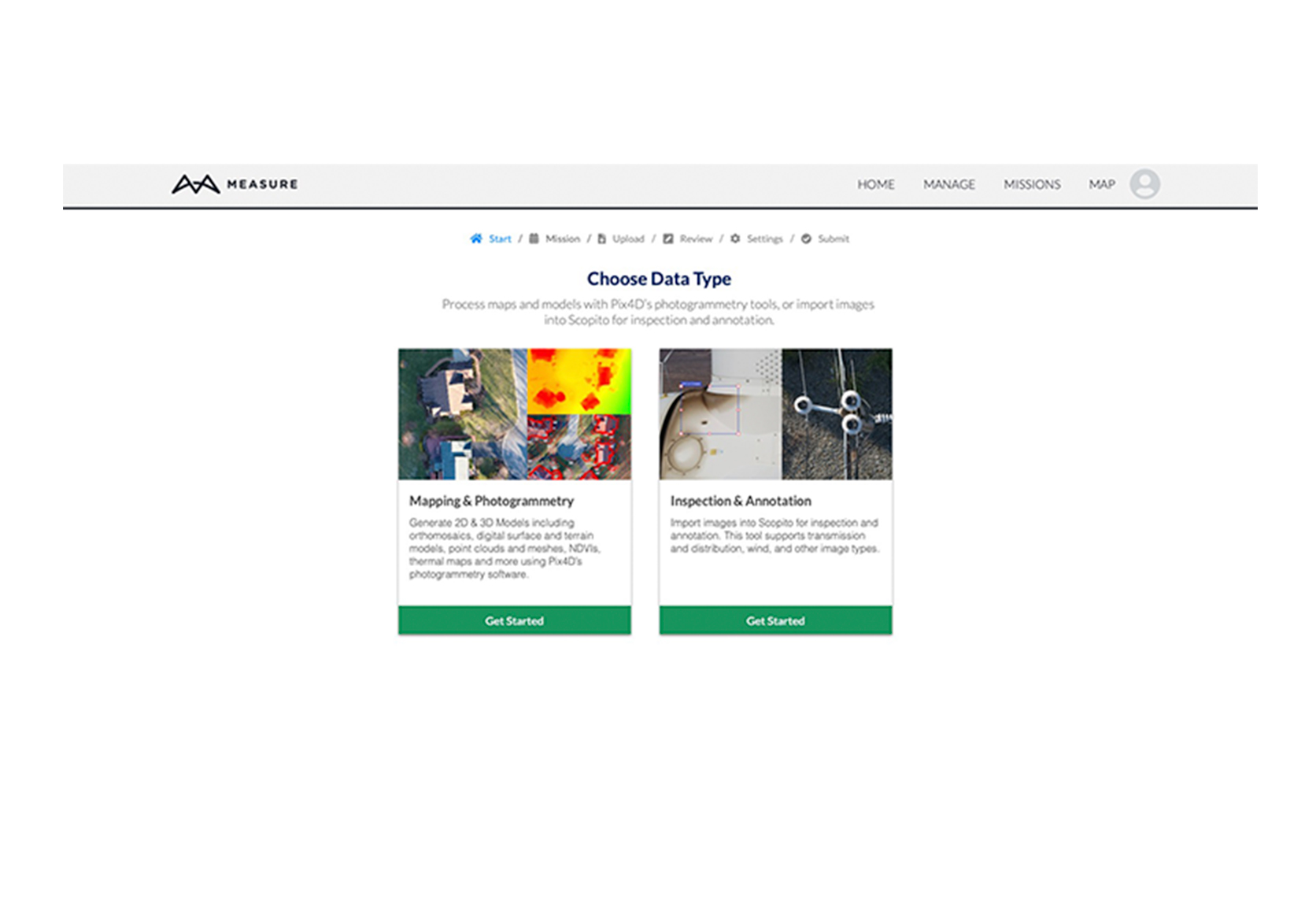
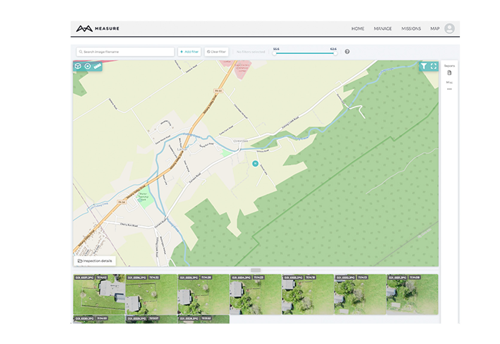
Artificial intelligence data tools powered by Scopito allow you to view, analyze, and report inspection data without ever leaving Ground Control.

Why 2 - Custom set-up

Custom set-up

Kickstart your program with an all-in-one software suite, tailored to the needs of your business. Enterprise customers can add inspection tools, integrations, and more.

  • Add your users, pilots, and equipment.
  • Add historical flight logs.
  • Create profiles for each user.
  • Get reports across various data types.
  • Customize flight checklists.
  • Train and onboard users within minutes.

Why 3 - Compatibility

Compatibility

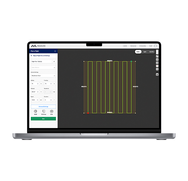
Fly and capture data with our user-friendly mobile app built for commercial use, available on iOS, Android, and DJI devices.

Measure Ground Control is compatible with a selection of drones and payloads.

Supported aircraft and equipment

Why 4 - Optimize workflow

Why Measure Ground Control

Optimize your workflow

Create new mission

Build missions from Measure Ground Control’s home screen. As a mission continues through each step, the mission status can be updated to provide stakeholders with insight into the operation.

Create flight plan

After you create a mission, you can choose from the list of existing flight plans or enter new coordinates to start a new one. You can upload a KML file, and customize the polygon flight pattern later. 

Check airspace

Use the airspace tool to check for any airspace advisories in your flight area. Filter local advisories according to your chosen rule set.

Allocate resources

Easily schedule personnel and equipment to missions at various sites from within the Ground Control web portal. Quickly see all personnel involved in a mission, from data capture to delivery.

Choose flight settings

Users can set general preferences and adjust flight settings, including local data mode, overlap, resolution, GNSS corrections, connection loss behaviors, camera settings, gimbal angle, and other advanced settings.

Monitor flight

During the flight, users can actively monitor the data for peace of mind. Every time an image is captured by the drone, a camera icon will appear, providing for an easy way to check the image overlap.

Process data

Generate 2D & 3D models including orthomosaics, digital surface (DSM) and terrain models (DTM), point clouds and meshes, NDVIs, thermal maps and more using Pix4D’s photogrammetry software.

Inspect data

Once saved to a mission, operators in the field can access these plans in the flight app for flight execution. Any edits made in the app will be reflected to that plan on the web.

Import images into Scopito (Enterprise plan) for inspection and annotation. This tool supports transmission and distribution, wind, and other image types.


Create and share reports

All data that Measure Ground Control tracks over time can be compiled through our reporting function. The reporting tool can produce PDF reports or CSV exports to filter and sort your data easily. Some of the reports you can automatically extract are 30-day equipment utilization, drone fleet activity, pilot activity report, flags report and more.

Create new mission
Create flight plan
Check airspace
Allocate resources
Choose flight settings
Monitor flight
Process data
Inspect data
Create and share reports

Create new mission

Build missions from Measure Ground Control’s home screen. As a mission continues through each step, the mission status can be updated to provide stakeholders with insight into the operation.

Create flight plan

After you create a mission, you can choose from the list of existing flight plans or enter new coordinates to start a new one. You can upload a KML file, and customize the polygon flight pattern later. 

Check airspace

Use the airspace tool to check for any airspace advisories in your flight area. Filter local advisories according to your chosen rule set.

Allocate resources

Easily schedule personnel and equipment to missions at various sites from within the Ground Control web portal. Quickly see all personnel involved in a mission, from data capture to delivery.

Choose flight settings

Users can set general preferences and adjust flight settings, including local data mode, overlap, resolution, GNSS corrections, connection loss behaviors, camera settings, gimbal angle, and other advanced settings.

Monitor flight

During the flight, users can actively monitor the data for peace of mind. Every time an image is captured by the drone, a camera icon will appear, providing for an easy way to check the image overlap.

Process data

Generate 2D & 3D models including orthomosaics, digital surface (DSM) and terrain models (DTM), point clouds and meshes, NDVIs, thermal maps and more using Pix4D’s photogrammetry software.

Inspect data

Once saved to a mission, operators in the field can access these plans in the flight app for flight execution. Any edits made in the app will be reflected to that plan on the web.

Import images into Scopito (Enterprise plan) for inspection and annotation. This tool supports transmission and distribution, wind, and other image types.


Create and share reports

All data that Measure Ground Control tracks over time can be compiled through our reporting function. The reporting tool can produce PDF reports or CSV exports to filter and sort your data easily. Some of the reports you can automatically extract are 30-day equipment utilization, drone fleet activity, pilot activity report, flags report and more.

Why 6 - Technical support

Top-notch technical support

We’re there for you. Our team has years of combined experience in drone software and operations. While our software is intuitive and accessible by design, your team can rest assured knowing we’ve got you covered whether you need support in-field or in-office.

Enterprise support includes:

  • US-based support via email and phone.
  • Regular check-ins with Measure’s support team.
  • Answers in real-time to operations and technical questions.

PD24-1: Pricing Module

Pricing

Which version is right for you?

PRO

$69 USD

per month (paid annually).

$99 USD if paid monthly

Get started
    View Plan Summary
  • Single User
  • Unlimited maps
  • Store captured images and flight data
  • Flight app with automatic logging
  • Mission scheduling
  • Equipment management
  • Flight telemetry and incident reporting
  • Export and share maps
ENTERPRISE

Contact us

Contact us
    View Plan Summary
  • Multiple Users
  • Unlimited maps
  • Store captured images and flight data
  • Flight app with automatic logging
  • Mission scheduling
  • Equipment management
  • Team and user management
  • Premium inspection and annotation tools
  • Program reporting
  • Flight telemetry and incident reporting
  • Export and share maps
  • Premium integrations: EAM/ERP systems, API, SSO, and more

Testimonials

Measure customer reviews

What our users say

“Measure has redefined the way we deliver drone training to new pilots. Instead of needing multiple tools, we are able to focus on a single platform and clearly define what deliverables can be created.”

“When we reach out to our account managers at Measure, we know our questions or concerns will be addressed as soon as possible. We can’t underscore enough how valuable it is to work with such a reliable team”.

“I like how it integrates everything into one spot, one program that has all the information from a mission or from an operator. It allows the user to focus on the task at hand which is flying the drone safely!”

Download MGC brochure

PD23-1: Form Module

Still determining if be a hubspot integrated/embedded form

Try Measure Ground Control

Newsletter sign up

Sign up to receive updates directly to your inbox.